
McCandless Township Neighbors by Parcel
Public information about a McCandless Township block is distributed among county parcel, map, land-record, and Town systems. The best starting point is the subject parcel because it provides a stable identifier when a road name, postal locality, or street number causes confusion. The records below show different parts of the picture. None converts the block into a personal roster, and the useful result is often a narrow answer about a parcel, boundary, recorded owner, or public project.
| Source | What It Shows About a Block | Access |
|---|---|---|
| Allegheny GIS Viewer | Parcel outlines, nearby properties, layers, measurement, and map context | Public map; geometry does not prove membership in a home |
| County property record | Recorded owner, situs and mailing distinction, parcel, tax, and assessment context | Address or parcel route; other occupants are not listed |
| Recorder deeds and plats | Owner/title chain, grantor-grantee roles, lot, block, subdivision, and recorded dates | Index is public; image, copy, and coverage rules vary |
| Town permit and planning records | Known-address projects, hearings, and dated municipal context | Archive, agenda, or focused RTKL request; not a neighbor list |
| Pennsylvania voter Street List | Limited registration fields by street under the Election Code | Formal request and use certification; ballot choices are not included |
| Northland and Heritage resources | Historic clubs, schools, maps, and local community context | Research or contact route; no verified member directory |
The distinction between a parcel and a person matters. County data can identify an owner of record and an official mailing field, while the GIS map shows where the parcel sits. A deed can explain a title change. Those facts should be kept separate from assumptions about current presence or personal relationships on the block.
McCandless Township Neighbors Start at One Parcel
Use the Allegheny Real Estate Portal to search the subject address first. The public screen uses Address or Parcel Number. Under Address, enter House Number and Street Name, omit the street suffix, and choose McCandless in the optional Municipality field when it helps distinguish a duplicate street. The result supplies Parcel ID, Owner Name, Address, and Municipality. Save the parcel ID exactly because it is the handoff to the GIS viewer, the deed index, tax information, and Town planning or zoning searches.
The county distinguishes the physical property location, owner mailing address, and tax-bill mailing address. All three can differ. This is a useful record-reading rule for McCandless Township neighbors: an off-site mailing field may show a correspondence destination rather than the location of a person. A property card can also display sale details, building and assessment information, map links, and prior-owner material, yet the County directs researchers to the Recorder for a complete sale and ownership trail.
Mapping McCandless Township Neighbors
The Allegheny County GIS Viewer is the geometry layer for a neighbor search. It supports address search, parcel display, layer controls, pan and zoom, measuring, printing, sharing, and basemap changes. Use it to see the subject polygon and the surrounding outlines, then return to the property portal for the specific address or parcel that needs confirmation. Measuring gives visual context, not a legal conclusion about adjacency.
- Search the subject address in the property portal and record its parcel ID and the date of the property information.
- Search the address in the GIS viewer, turn on the parcel layer, and zoom until surrounding parcel outlines are visible.
- Click or map-browse only the nearby polygons needed for the question, then check each returned address or parcel in the property record.
- Where a line or subdivision is unclear, compare the current parcel polygon, recorded deed or plan legal description, and the relevant plat before drawing a boundary conclusion.
A whole named road needs a longer address-record chain than this immediate-block method. The McCandless Township street directory follows that broader by-street workflow. For a past block, compare the confirmed parcel and legal description with historic Hopkins or Warrantee map material, then follow only documented transfers in the Recorder.
McCandless Township Neighbors: Parcel Names Are Not a Household
A current parcel card names recorded owner or owners, not everyone connected with a home. The County’s property record may show a situs address, owner mailing address, tax-bill mailing address, sale date, deed book/page, and homestead or farmstead indicator. These items each have a record purpose. A homestead or farmstead flag is tax-program evidence for the relevant period, not a list of people. A mailing field may be a post-office box, trust, business, or agent address.
| Official record route | Commercial neighbor compilation |
|---|---|
| Connects a specific claim to the County, Recorder, Town, or state custodian and its record date. | May combine records of different dates and different people with similar names. |
| Lets a reader seek a correction from the office that maintains the source record. | Does not replace the custodian’s record or its correction channel. |
| States record-specific access limits, including protected addresses and sealed material. | Should never be treated as proof of who is currently at a property. |
This is the key local misconception to avoid: a map and parcel owner can explain nearby properties, but they do not produce a verified list of McCandless Township neighbors. Keep the source type, date, and legal role beside every name that is considered.
McCandless Township Neighbors and Voter Lists
Pennsylvania’s individual Am I Registered? service is for confirming a particular record. It cannot be used to browse a block. A separate Department of State Street List can contain name, residence or mailing address, party, and active or inactive status, but it is obtained by a formal request under Title 25. The requester identifies themselves and certifies a permitted elections, political, or law-enforcement use.
The official voter-list request form documents the $20 electronic products and required certification. Street List information must not be republished, protected and cancelled voters are excluded, and ballot selections are never supplied. Allegheny County Elections handles record corrections. A status or list entry is a point-in-time registration fact, not a permanent proof of a McCandless Township address.
Note: Treat a voter-list request as a regulated records channel, not a shortcut around the individual voter-status lookup.
McCandless Township Neighbors and Planning Records
Town files add context to a parcel without turning into a list of neighbors. Monthly Permit Reports can place work at an address and date. The Town Agenda Center searches Council, Planning Commission, and Zoning Hearing Board material by time period, dates, word or phrase, and category. A known address, parcel, project name, or date is the right way to search those records. An older permit, occupancy, or code file may instead require a focused written request through the Town’s Right-to-Know process.
The Town planning-records search is the official entry point for Planning Commission and Zoning Hearing Board agenda material.
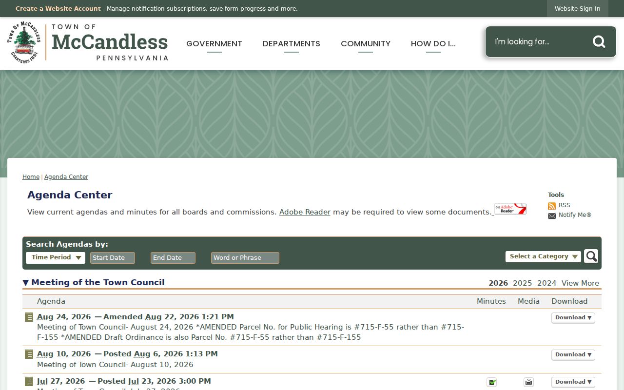
A planning item can explain a construction proposal, zoning matter, or recorded public meeting. It is not a title determination, and it should be paired with the parcel ID, property record, and recorded plan or deed when a boundary or ownership point matters.
Note: Preserve the address, parcel, project context, and meeting date when using a Town file to explain a change.
McCandless Township Neighbors in Community History
The local community layer is real, but research did not locate an official directory of active neighborhood associations, boundaries, membership, or public contact lists. The Town references a McCandless Community Association in historic and anniversary materials, and Northland identifies local associations as historical resources. Those references are useful for community or family-history research. They do not establish membership from a street address.
| Community resource | What the documented resource offers | Access boundary |
|---|---|---|
| McCandless Community Association | Named in Town historic and anniversary materials | No verified current directory, boundary list, or public roster was found |
| McCandless/Northern Allegheny Heritage and Cultural Center | School, family, service-group, house-history, and local-clipping material | Contact with names, approximate years, or historical street context |
| Northland Local History | Maps, newspaper links, historical material, and local-association leads | Historical research route, not a present member list |
The Heritage Center’s collections are designed around everyday North Allegheny history, including school records, family histories, and service-group scrapbooks. That makes them strong context for a past block or family story after a property is anchored, especially where county land records have a date or image gap.
McCandless Township Neighbor Deeds and Boundaries
When a current map line needs stronger support, move to the Recorder. The Official Record Search advanced route supports party, grantor, grantee, recorded-date, document-number, book/page, OCR, and parcel-ID searches. A parcel ID is entered as 14 to 17 digits without dashes. For an older route, the legacy Recorder search has fielded name, document, block-and-lot map, historical card, historical plat, and parcel-ID tabs.
Record the grantor or grantee role, recorded date, document type, book/page or instrument number, and legal description. For an older block, compare those confirmed terms with the 1906 and 1940 Hopkins maps or the 1914 Warrantee atlas. North Park and municipal boundary roads can create nearby polygons that are public land or outside Town jurisdiction. A GIS measurement is helpful, but it does not replace a survey or recorded boundary document.
Note: A recorded legal description carries more boundary weight than a visual line or an address label on a map.
McCandless Township Neighbor Privacy
Pennsylvania protects records that a parcel or map search cannot supply. The Address Confidentiality Program gives eligible survivors a substitute address and makes actual-address and application records confidential under 23 Pa.C.S. ch. 67. Court restrictions, current vital-record rules, driver-data protections, and voter-access limits continue to apply even when another official record is public. Private utility and delivery records are not a block-information source.
Use the record’s correction channel when an official field is wrong: county property data for address facts, Elections for voter updates, the filing court for docket corrections, and Vital Records for amendments. A public map, permit reference, or docket search cannot be used to defeat a protected address or to infer information the custodian did not make public.
Lawful use. Use McCandless Township neighbor records for personal, lawful research and civic context. Do not use a result to stalk, harass, intimidate, or harm anyone.